Description
MicroSurvey STARNET Review: Powerful Least Squares Network Adjustment Software for Surveying Professionals
When surveying data needs to be more than simply collected, it must be tested, adjusted, and trusted. This is where MicroSurvey STARNET stands out. Designed for professional surveyors, engineers, geospatial specialists, and technical organizations, MicroSurvey STARNET is a specialized least squares network adjustment software solution built to analyze complex surveying networks with accuracy and statistical confidence.
In real-world surveying, even high-quality field observations can contain small errors. Instrument limitations, environmental conditions, observation geometry, and human factors can all affect results. Rather than relying only on basic calculations or manual corrections, STARNET uses advanced network adjustment methods to evaluate observations, identify inconsistencies, calculate the most reliable coordinates, and provide statistical analysis of the entire survey network.
For professionals working with GPS/GNSS observations, total station measurements, leveling data, azimuths, distances, angles, and mixed surveying observations, MicroSurvey STARNET provides a structured way to transform raw survey data into dependable results.
Introduction to MicroSurvey STARNET
Surveying projects often involve hundreds or thousands of observations connected across a network of points. The challenge is not simply calculating coordinates. The real challenge is determining whether the observations are consistent and how much confidence can be placed in the final results.
MicroSurvey STAR*NET is designed to solve this problem through rigorous least squares adjustment. The software analyzes a network of observations and calculates the most statistically probable solution while also identifying potential errors and weak areas in the network.
This makes STARNET particularly useful when accuracy, reliability, and documentation are essential.
Imagine a surveying team working on a large infrastructure project. Multiple crews collect GNSS observations, total station measurements, and leveling data over several days. Each observation may appear reasonable on its own, but when all measurements are combined, small differences can appear between points.
Instead of adjusting each measurement manually, the surveyor can use MicroSurvey STARNET to process the complete network. The software evaluates the observations together, applies mathematical adjustment methods, and produces a more reliable result supported by statistical analysis.
That combination of accuracy and analytical control is what makes STARNET valuable for professional surveying workflows.
What Is MicroSurvey STARNET Used For?
MicroSurvey STARNET is primarily used for survey network adjustment and statistical analysis. Its core purpose is to help professionals evaluate surveying observations and calculate adjusted coordinates.
The software can be used for projects involving:
- Horizontal survey network adjustment
- Vertical leveling network adjustment
- Three-dimensional surveying networks
- GPS and GNSS observations
- Total station observations
- Distance and angle measurements
- Azimuth and bearing observations
- Mixed observation networks
- Quality control and error detection
- Coordinate reliability analysis
By combining different types of survey observations, users can create a more complete model of their project network.
Key Features of MicroSurvey STARNET
Advanced Least Squares Network Adjustment
The central feature of MicroSurvey STARNET is its least squares adjustment engine. This mathematical method is widely used in professional surveying because it allows multiple observations to be evaluated simultaneously.
Rather than treating each measurement independently, the software considers the relationships between observations. This helps determine the most statistically consistent solution for the entire network.
For surveyors working on complex projects, this can provide a much stronger foundation than simple coordinate calculations.
Support for Multiple Observation Types
Modern surveying projects often combine data from several instruments and methods. MicroSurvey STARNET is designed to work with a wide variety of observation types.
Depending on the project and workflow, users can work with:
- Horizontal distances
- Slope distances
- Angles
- Directions
- Azimuths
- Elevation differences
- GPS or GNSS vectors
- Coordinate observations
This flexibility is particularly useful for hybrid survey projects where GNSS, conventional instruments, and leveling data are combined.
Statistical Error Analysis
A major advantage of professional adjustment software is the ability to analyze the quality of observations.
MicroSurvey STARNET helps users examine potential problems within a network. Statistical results can help identify observations that may require further investigation.
This is important because an unusual result does not always mean the measurement is automatically wrong. It may indicate a problem with field procedures, instrument calibration, observation conditions, or network geometry.
By providing statistical information, STARNET gives surveyors more evidence when making technical decisions.
Network Quality Control
Quality control is one of the most important parts of professional surveying. A network may appear acceptable on the surface while containing weaknesses that could affect the final project.
STARNET helps users evaluate the network as a whole. Surveyors can review adjustment results, analyze residuals, examine coordinate precision, and investigate observations that do not fit the network well.
This makes the software useful not only for final calculations but also for improving field survey procedures.
Flexible Network Configuration
Different projects require different network designs. A small boundary survey does not have the same requirements as a major transportation or construction project.
MicroSurvey STARNET provides the flexibility needed to work with different network configurations and observation combinations.
This allows users to build an adjustment model that reflects the actual structure of their survey project.
Practical Use Cases for MicroSurvey STARNET
Construction Surveying
Large construction projects often depend on reliable control networks. A small coordinate error can create problems when transferring design information to the field.
STARNET can be used to adjust control networks and improve confidence in the coordinates used for construction layout.
For example, a survey team working on a large commercial development may combine GNSS observations with total station measurements. By adjusting the network, the team can identify inconsistencies before the coordinates are used for construction work.
Transportation and Infrastructure Projects
Roads, railways, bridges, tunnels, and other infrastructure projects often require extensive control networks.
These projects may involve:
- Long distances
- Multiple survey crews
- Complex terrain
- Multiple observation sessions
- Strict accuracy requirements
MicroSurvey STARNET can help analyze the network and provide a more reliable adjustment solution.
For a highway project, for instance, surveyors may establish control points over a large corridor. The adjustment process helps ensure that the network remains consistent from one section of the project to another.
Boundary and Cadastral Surveying
Property and cadastral surveys often involve complex relationships between existing monuments, measured distances, directions, and coordinate systems.
A network adjustment program can help surveyors evaluate observations and understand how different measurements influence the final positions of points.
This is especially useful when dealing with multiple sources of survey evidence.
Geodetic and GNSS Surveying
GNSS technology has transformed modern surveying, but satellite observations still require careful processing and quality control.
MicroSurvey STARNET can be useful for professionals working with GNSS-related observations as part of a larger network adjustment workflow.
Instead of relying only on individual coordinate results, surveyors can evaluate how GNSS observations interact with other measurements in the network.
Engineering and Monitoring Projects
Some engineering projects require repeated measurements over time. These may include monitoring structures, ground movement, or other changes in a survey network.
Reliable adjustment methods can help distinguish between genuine movement and measurement variation.
For monitoring applications, this type of statistical analysis can provide valuable insight into whether observed coordinate changes are significant.
Performance Analysis: How Does MicroSurvey STARNET Perform?
The strongest aspect of MicroSurvey STARNET is its focus. It is not designed to be a general-purpose CAD program or a basic coordinate calculator. Its primary purpose is professional network adjustment and analysis.
That specialization can be a major advantage for users who need advanced surveying calculations.
Accuracy and Reliability
For professional surveying workflows, accuracy is more than a final number. Users need to understand how the result was produced and whether the observations support it.
STARNET’s adjustment-based approach provides a structured mathematical process for evaluating survey networks.
The ability to review statistical results can improve confidence in the final coordinates.
Handling Complex Networks
Simple networks can often be calculated using basic tools. The real challenge appears when a project includes multiple observation types and numerous interconnected points.
This is where specialized network adjustment software becomes more valuable.
MicroSurvey STARNET is designed for these more demanding scenarios, allowing professionals to work with complex relationships between observations.
Professional Workflow Integration
Surveyors often use several software applications throughout a project. Field data may come from GNSS equipment, total stations, data collectors, or other surveying systems.
The practical value of STARNET depends partly on how well it fits into the user’s existing workflow and data exchange process.
For organizations already using professional surveying software, a dedicated adjustment tool can become an important part of the quality-control process.
User Experience and Learning Curve
MicroSurvey STARNET is designed for a technical audience, so new users should expect a learning curve.
A beginner who has never worked with least squares adjustment may initially find concepts such as residuals, standard deviations, statistical testing, and network geometry difficult.
However, users with a background in surveying or geodesy will generally find the software’s purpose easier to understand.
A practical learning approach is to begin with a small network:
- Import or enter a limited set of observations.
- Run a basic adjustment.
- Review the adjustment report.
- Examine residuals and precision results.
- Compare the adjusted coordinates with expected values.
- Gradually move to larger and more complex projects.
This approach helps users understand the relationship between field observations and the final adjusted network.
Pros and Cons of MicroSurvey STARNET
Pros
- Designed specifically for professional survey network adjustment
- Supports complex surveying workflows
- Useful for least squares adjustment analysis
- Helps identify inconsistencies and potential measurement problems
- Supports quality control and statistical evaluation
- Suitable for mixed observation networks
- Valuable for engineering, construction, geodetic, and cadastral projects
- Provides a more rigorous alternative to basic coordinate calculations
Cons
- May be more advanced than necessary for simple surveying projects
- Requires an understanding of surveying and adjustment concepts
- New users may need time to learn the statistical workflow
- The best value is typically achieved by professional or technically experienced users
- Licensing and current availability should be verified according to the user’s specific requirements
Pricing and Plans
The pricing and licensing structure for MicroSurvey STARNET may vary depending on the edition, licensing model, reseller availability, support options, and current product offerings.
For professional users, the most important consideration is not simply the initial software cost. Organizations should also evaluate:
- Number of required users
- License flexibility
- Technical support
- Update policies
- Compatibility with existing survey workflows
- Training requirements
- Long-term project needs
Because software pricing and licensing can change over time, buyers should confirm the current commercial terms before making a purchase decision.
Who Should Use MicroSurvey STARNET?
MicroSurvey STARNET is a strong choice for professionals who need more than basic surveying calculations.
It may be particularly suitable for:
- Land surveyors
- Geodesists
- Civil engineers
- Surveying companies
- Construction survey teams
- Transportation project teams
- GIS and geospatial professionals
- Engineering consultants
- Universities and technical training organizations
It is especially useful when a project requires reliable network adjustment, statistical quality control, and detailed analysis of surveying observations.
MicroSurvey STARNET vs. Basic Survey Calculation Tools
Basic surveying software can be useful for straightforward calculations, coordinate conversions, and field data management.
However, complex networks require a more advanced approach.
The key difference is that MicroSurvey STARNET is focused on evaluating the network as a connected mathematical system. This allows users to analyze how observations influence one another and how errors may affect the final result.
For a simple project, a basic tool may be sufficient. For a large or accuracy-sensitive project, specialized adjustment software can provide a much stronger analytical foundation.
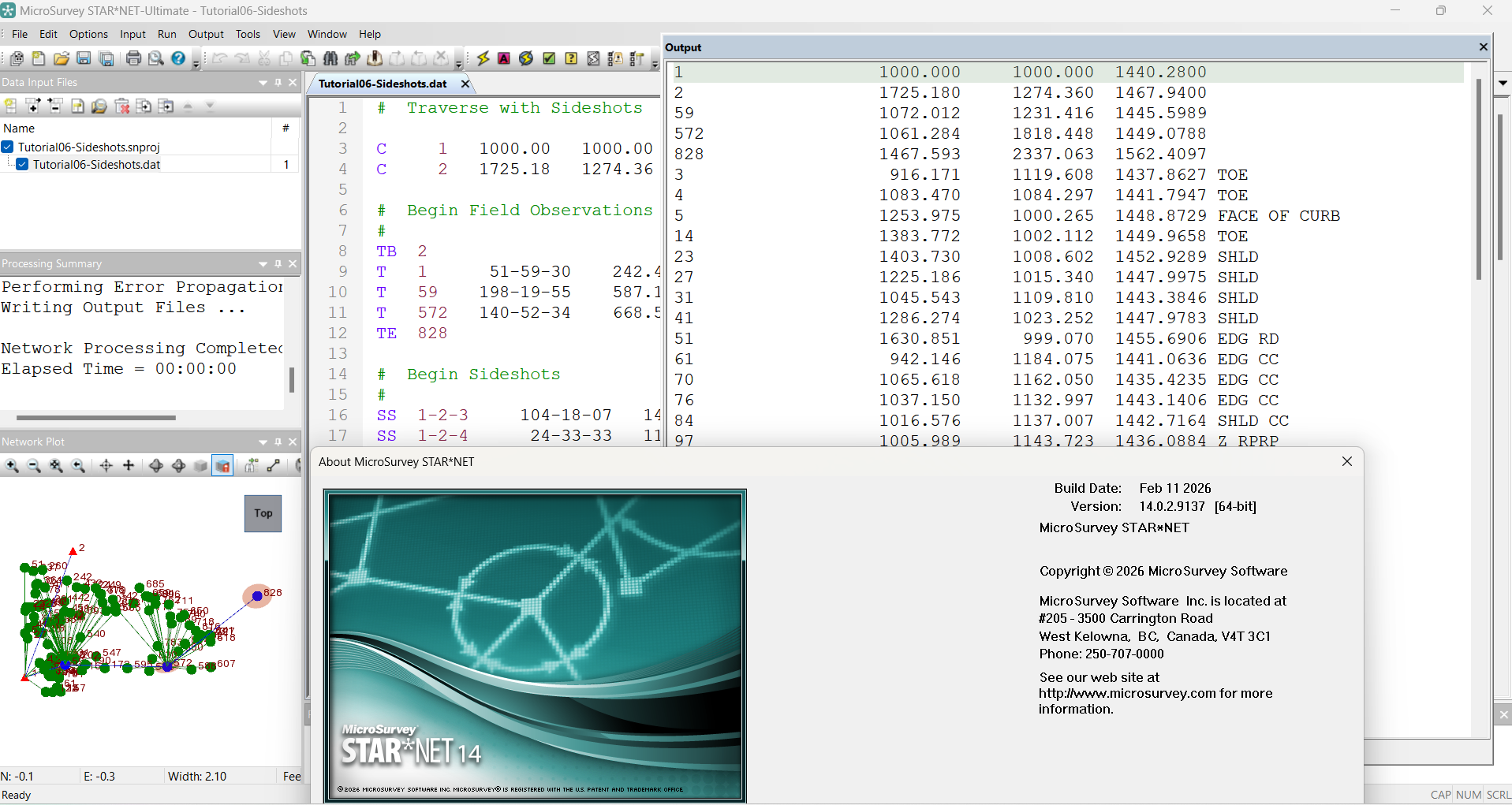
MicroSurvey STARNET 14.0.2.9137
Final Verdict
MicroSurvey STARNET is a specialized and technically focused solution for professionals who need dependable survey network adjustment and statistical analysis. Its strength lies in its ability to evaluate complex observation networks rather than simply producing basic coordinate calculations.
For a professional surveyor, the software can help answer important questions:
- Are the observations consistent?
- Which measurements may require investigation?
- How reliable are the adjusted coordinates?
- How strong is the survey network?
- Can the final results be supported by statistical analysis?
These questions matter in construction, infrastructure, geodetic, cadastral, and engineering projects where inaccurate survey information can lead to costly consequences.
The software may require some technical knowledge, particularly for users unfamiliar with least squares adjustment and statistical surveying concepts. However, for professionals willing to learn its workflow, MicroSurvey STARNET can become a valuable part of a modern survey quality-control process.
If your work involves complex survey networks, mixed observations, GNSS data, control networks, or accuracy-sensitive engineering projects, exploring MicroSurvey STARNET could be a practical step toward improving the reliability and confidence of your surveying results. A well-adjusted network is not simply a collection of calculated points; it is a tested, analyzed, and defensible foundation for professional decision-making.




Reviews
There are no reviews yet.