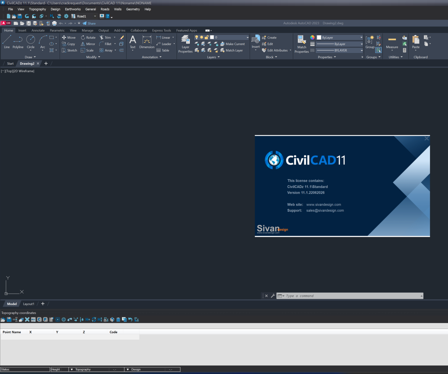
Description
CivilCAD Review: A Powerful Civil Engineering and Land Development Software for Modern Infrastructure Projects
Summary
CivilCAD is a comprehensive civil engineering software designed to simplify surveying, road design, land development, hydraulic analysis, and infrastructure planning. Built to work alongside CAD environments, it provides engineers, surveyors, contractors, and consultants with specialized tools that reduce manual calculations and accelerate project completion.
Whether you’re designing highways, preparing topographic maps, calculating earthwork volumes, or creating sewer and water distribution networks, CivilCAD helps improve productivity while maintaining engineering accuracy. Its practical workflow, automation capabilities, and extensive design tools make it a trusted solution for professionals handling residential, commercial, and public infrastructure projects.
For engineering firms seeking reliable civil design software, CivilCAD offers an excellent balance between functionality, efficiency, and ease of use.
Introduction
Civil engineering projects involve thousands of calculations, drawings, elevations, alignments, and design decisions. Managing all these tasks manually not only consumes valuable time but also increases the likelihood of costly errors.
This is where CivilCAD becomes an invaluable engineering companion.
CivilCAD is developed specifically for civil engineering professionals who need powerful design automation without sacrificing flexibility. Instead of relying on multiple disconnected software tools, engineers can complete surveying, grading, road layouts, drainage systems, and terrain modeling from one integrated platform.
From small residential developments to large transportation infrastructure, CivilCAD streamlines every stage of project planning and execution.
Its automation tools allow engineers to spend less time performing repetitive calculations and more time improving overall project quality.
Key Features of CivilCAD
CivilCAD includes a rich collection of engineering tools that support virtually every stage of land development and civil infrastructure design.
Advanced Surveying Tools
Survey data processing is one of CivilCAD’s strongest capabilities.
Engineers can:
- Import field survey information
- Generate topographic maps
- Process coordinate data
- Create contour maps
- Build terrain models
- Visualize elevation changes
These features significantly reduce the workload involved in preparing accurate site plans.
Road Design and Highway Engineering
CivilCAD offers comprehensive road design functionality suitable for municipal roads, highways, industrial access roads, and residential developments.
Features include:
- Horizontal alignment design
- Vertical profile generation
- Cross-section creation
- Road corridor modeling
- Curve calculations
- Stationing automation
- Earthwork quantity calculations
The software minimizes repetitive drafting while improving engineering precision.
Digital Terrain Modeling (DTM)
Terrain modeling plays a critical role in infrastructure planning.
CivilCAD allows users to:
- Build Digital Terrain Models
- Generate contour intervals
- Analyze slopes
- Calculate cut and fill volumes
- Visualize terrain changes
- Optimize grading designs
These tools help engineers make informed design decisions before construction begins.
Earthwork Volume Calculations
Estimating excavation and fill requirements manually can be extremely time-consuming.
CivilCAD automates:
- Cut and fill calculations
- Surface comparisons
- Material quantity reports
- Excavation estimates
- Land grading analysis
This automation improves estimating accuracy while saving significant engineering hours.
Water Supply and Sewer Network Design
Infrastructure projects often require complex utility planning.
CivilCAD provides tools for:
- Sewer network design
- Stormwater drainage
- Water distribution systems
- Hydraulic calculations
- Pipe sizing
- Manhole layouts
- Utility profile generation
These integrated utilities simplify municipal engineering workflows.
Parcel and Land Development Tools
Urban planners and land developers benefit from CivilCAD’s subdivision capabilities.
Users can create:
- Property subdivisions
- Lot layouts
- Parcel calculations
- Area reports
- Land development plans
- Boundary documentation
These tools streamline residential and commercial development projects.
Hydraulic Engineering Support
CivilCAD includes engineering modules for hydraulic analysis that assist in designing efficient drainage systems.
Capabilities include:
- Flow calculations
- Channel design
- Culvert analysis
- Stormwater planning
- Drainage network evaluation
This functionality supports environmentally responsible infrastructure development.
Practical Use Cases
CivilCAD serves professionals across numerous engineering industries.
Civil Engineering Firms
Engineering consultants use CivilCAD for:
- Infrastructure planning
- Municipal projects
- Roadway engineering
- Residential developments
- Commercial site design
The software helps deliver projects more efficiently while maintaining engineering standards.
Surveying Companies
Surveyors rely on CivilCAD to transform raw field measurements into detailed engineering drawings.
Instead of manually processing thousands of survey points, they can automatically generate terrain models, contour maps, and coordinate reports.
This saves hours of repetitive work.
Government Infrastructure Projects
Municipal agencies frequently require accurate road layouts, drainage systems, and utility planning.
CivilCAD simplifies:
- Public road improvements
- Utility expansion
- Land subdivision
- Urban development
- Transportation planning
Its organized workflows support large-scale infrastructure management.
Construction Contractors
Contractors benefit from CivilCAD during project estimation.
The software assists with:
- Earthwork estimation
- Quantity takeoffs
- Site grading
- Excavation planning
- Material calculations
Accurate estimates reduce unexpected construction costs.
Educational Institutions
Universities and engineering colleges often introduce students to civil design principles through professional engineering software.
CivilCAD helps students understand:
- Surveying techniques
- Road engineering
- Hydraulic design
- Land development
- Terrain analysis
Its practical workflows mirror real engineering projects.
Performance Analysis
CivilCAD performs exceptionally well for engineering projects that involve extensive drafting and technical calculations.
One of its greatest strengths is automation.
Tasks that traditionally require hours of manual drafting can often be completed within minutes.
Large topographic datasets are processed efficiently, allowing engineers to generate contour maps and Digital Terrain Models without excessive manual effort.
The software also improves consistency by applying engineering standards throughout the design process.
Because CivilCAD integrates with CAD-based environments, users familiar with technical drafting generally experience a smoother learning curve than with entirely new software platforms.
For firms handling multiple civil infrastructure projects simultaneously, CivilCAD offers a noticeable productivity improvement by reducing repetitive work and minimizing design errors.
User Experience
Many engineering professionals appreciate CivilCAD because it focuses on practical workflows rather than unnecessary complexity.
Instead of forcing users through complicated processes, the software organizes commands according to engineering tasks.
For example, after importing survey data, engineers can quickly generate terrain models, calculate earthwork, design road alignments, and prepare final drawings within the same working environment.
This integrated approach improves project efficiency while reducing software switching.
Experienced engineers value the advanced capabilities, while newer professionals often appreciate the guided workflows and organized toolsets.
Pros and Cons
Pros
- Comprehensive civil engineering toolkit
- Excellent surveying and terrain modeling capabilities
- Powerful road design automation
- Accurate earthwork volume calculations
- Efficient utility and drainage design tools
- CAD-integrated workflow
- Suitable for projects of various sizes
- Improves engineering productivity
- Reduces repetitive drafting tasks
- Supports professional infrastructure planning
Cons
- Beginners may require time to master advanced engineering modules
- Performance depends on computer hardware when handling very large projects
- Some advanced features may exceed the needs of small design firms
- Licensing options vary depending on edition and region
Pricing & Plans
CivilCAD licensing and pricing may vary based on:
- Software edition
- License type
- Commercial or educational use
- Regional distributor
- Maintenance or support options
Organizations should evaluate the available licensing plans to select the option that best matches their project requirements, team size, and long-term engineering needs.
Why CivilCAD Stands Out
Unlike many general drafting applications, CivilCAD focuses specifically on civil engineering workflows.
Its specialized tools allow professionals to:
- Automate engineering calculations
- Produce accurate technical drawings
- Improve project consistency
- Reduce design errors
- Complete projects faster
- Generate professional engineering documentation
This combination of automation and engineering intelligence makes CivilCAD a valuable investment for firms seeking greater productivity.
Final Verdict
CivilCAD is a feature-rich civil engineering software solution that combines surveying, road design, terrain modeling, hydraulic analysis, earthwork estimation, and land development into one efficient platform. Its automation capabilities significantly reduce repetitive engineering tasks while improving design accuracy and overall productivity.
Whether you are a consulting engineer, surveyor, contractor, infrastructure planner, or engineering student, CivilCAD provides the specialized tools needed to complete projects with confidence and precision. Its balance of powerful functionality and practical workflows makes it an excellent choice for professionals involved in modern civil engineering.
If you’re looking for dependable civil engineering software that can streamline project planning, improve design accuracy, and support efficient infrastructure development, CivilCAD is well worth exploring for your next project.



Reviews
There are no reviews yet.