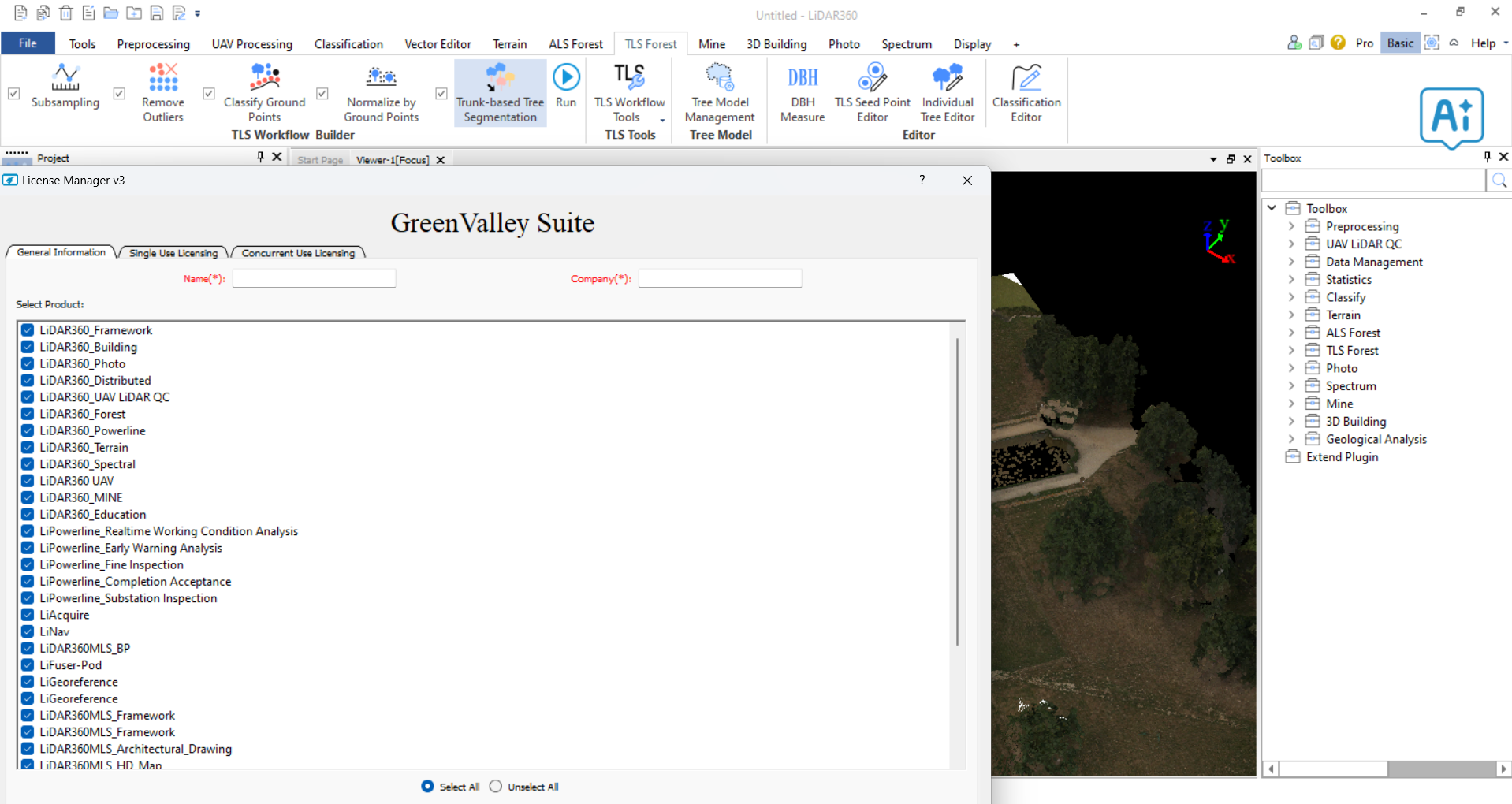
Description
GreenValley Lidar360 9.0: Powerful LiDAR Processing for Surveying, Mapping, and 3D Geospatial Workflows
Quick Summary
GreenValley Lidar360 is a specialized geospatial software solution designed to help professionals process, analyze, visualize, and manage LiDAR and 3D point cloud data more efficiently. For surveyors, engineers, GIS professionals, drone mapping teams, forestry specialists, and infrastructure planners, the software provides a practical environment for turning massive LiDAR datasets into useful information.
The real value of GreenValley Lidar360 becomes clear when working with large point clouds that are difficult to manage using basic mapping tools. Instead of treating LiDAR data as nothing more than a dense collection of points, the software helps users explore terrain, classify data, generate digital elevation models, inspect 3D environments, and extract valuable information for real-world projects.
Whether the goal is topographic surveying, corridor mapping, terrain analysis, forestry inventory, or infrastructure planning, GreenValley Lidar360 can help create a more structured and efficient LiDAR processing workflow. Its combination of point cloud visualization, geospatial analysis, terrain modeling, and data management makes it an interesting choice for organizations that regularly work with aerial LiDAR, terrestrial scanning, mobile mapping, and drone-generated 3D data.
Introduction
LiDAR technology has changed the way professionals collect and understand the physical world. A single LiDAR survey can produce millions or even billions of points representing terrain, buildings, vegetation, roads, bridges, and other objects. The challenge is no longer simply collecting data. The real challenge is processing that data efficiently and converting it into accurate, usable information.
This is where GreenValley Lidar360 enters the workflow.
For someone working on a small mapping project, handling a point cloud may appear straightforward. However, as datasets grow, common problems quickly appear. Files become large, visualization becomes slower, classification requires more effort, and extracting meaningful terrain information can become time-consuming.
Green Valley Lidar 360 is designed to address these challenges by offering tools for working with LiDAR and point cloud data in a more organized environment. Its applications can extend from basic inspection to advanced analysis, depending on the specific workflow and product configuration being used.
For professionals who work with geospatial data every day, software that can reduce manual processing and improve data interpretation can make a significant difference.
What Is GreenValley Lidar360?
GreenValley Lidar360 refers to LiDAR-focused software and processing solutions developed for managing and analyzing 3D geospatial data. The platform is associated with workflows involving point cloud processing, terrain modeling, LiDAR visualization, mapping, surveying, and 3D data analysis.
The software can be useful for handling different types of LiDAR data, including:
- Airborne LiDAR datasets
- Drone-based LiDAR surveys
- Mobile mapping point clouds
- Terrestrial laser scanning data
- Digital elevation data
- Classified point cloud information
- Large-scale 3D geospatial datasets
One of the main advantages of using specialized LiDAR software is that it is built around the unique characteristics of point cloud data. Traditional GIS software can be powerful, but LiDAR processing often requires dedicated tools for classification, filtering, measurement, terrain extraction, and 3D visualization.
GreenValley Lidar360 is therefore aimed at users who need more than a simple map viewer. It is designed to support workflows where raw 3D data must be inspected, processed, analyzed, and transformed into project-ready information.
Key Features of GreenValley Lidar360
Advanced Point Cloud Visualization
One of the first things users need when working with LiDAR is a clear way to see their data. GreenValley Lidar 360 provides a 3D environment for examining dense point clouds and understanding the structure of a surveyed area.
Users can inspect:
- Ground surfaces
- Buildings
- Roads
- Trees and vegetation
- Bridges
- Utility corridors
- Slopes and terrain features
A strong 3D visualization workflow is especially useful when dealing with large datasets where traditional 2D maps cannot communicate the full structure of the environment.
LiDAR Data Processing
Raw LiDAR data often requires processing before it can be used for engineering or mapping purposes. Depending on the workflow, users may need to clean data, organize point clouds, classify points, and remove unwanted information.
LiDAR processing capabilities can help users prepare datasets for:
- Terrain modeling
- Topographic mapping
- Infrastructure analysis
- Digital surface model generation
- Digital terrain model creation
- 3D visualization
- GIS integration
The ability to process data within a specialized environment can help reduce the need for multiple disconnected applications.
Point Cloud Classification
Classification is one of the most important parts of LiDAR processing. A point cloud may contain ground points, vegetation, buildings, vehicles, poles, and other objects. Separating these elements helps users create more accurate models and perform better analysis.
For example, a surveyor may need to isolate ground points to create a bare-earth terrain model. A forestry professional may instead be interested in vegetation height and canopy structure.
Classification tools can make these workflows more efficient and reduce repetitive manual editing.
Terrain Analysis and Modeling
LiDAR is widely used for understanding the shape of the land. GreenValley Lidar 360 can support workflows involving terrain analysis and surface modeling.
Possible outputs may include:
- Digital Terrain Models
- Digital Surface Models
- Elevation models
- Contour information
- Slope analysis
- Terrain visualization
These capabilities are valuable for civil engineering, flood studies, road design, construction planning, and environmental analysis.
Large Dataset Handling
Large LiDAR datasets can quickly become difficult to manage. A professional solution needs to provide an efficient approach to navigating, loading, and analyzing large volumes of 3D data.
GreenValley Lidar360 is particularly relevant to organizations that regularly work with extensive point cloud projects. The ability to organize and work with large datasets can improve productivity and help teams avoid unnecessary data conversion and duplication.
3D Measurement and Inspection
A 3D point cloud becomes significantly more useful when users can measure real-world features directly from the data.
Depending on the available tools and workflow, users may inspect:
- Distances
- Elevation differences
- Object dimensions
- Terrain slopes
- Vertical clearances
- Structural features
These measurements can support engineering inspections, asset management, surveying, and construction verification.
Practical Use Cases
Surveying and Topographic Mapping
Surveying teams can use LiDAR data to create detailed representations of terrain and existing conditions. Instead of relying only on traditional field measurements, professionals can analyze a much larger area from a single survey dataset.
A surveyor working on a large development site, for example, can use LiDAR data to understand elevation changes, identify terrain features, and generate accurate surface information.
This can save considerable time, especially in areas that are difficult or dangerous to access.
Drone Mapping and Reality Capture
Drone-based LiDAR is increasingly popular for capturing detailed 3D information. GreenValley Lidar 360 can fit naturally into workflows where drone data needs to be processed and analyzed after a flight.
A typical workflow might involve:
- Collecting LiDAR data using a drone.
- Importing the point cloud into the processing environment.
- Reviewing the captured 3D data.
- Classifying relevant features.
- Creating terrain or surface models.
- Exporting information for further engineering or GIS work.
This workflow can be useful for construction sites, mining areas, forests, roads, and large properties.
Forestry and Vegetation Analysis
LiDAR is highly valuable in forestry because it can reveal the vertical structure of vegetation. Unlike ordinary aerial imagery, LiDAR can provide information about canopy height and the relationship between vegetation and the ground.
Professionals may use LiDAR data to analyze:
- Forest structure
- Tree height
- Canopy density
- Vegetation distribution
- Terrain beneath vegetation
For forestry teams, this type of information can support planning, environmental assessment, and resource management.
Road and Corridor Mapping
Roads, railways, pipelines, and power transmission corridors often require detailed mapping over long distances.
A LiDAR-based workflow can help teams inspect terrain and identify potential issues along a corridor. Engineers may use point cloud data to study slopes, clearances, vegetation encroachment, and existing infrastructure.
This makes specialized LiDAR processing software valuable for transportation and utility projects.
Construction and Infrastructure
Construction teams can use 3D point clouds to compare existing conditions with planned designs. LiDAR data can support progress monitoring, site documentation, and verification of completed work.
For example, a construction manager may use a point cloud to review a site before construction begins and then compare later scans to understand how the project has changed.
This type of reality capture can improve documentation and provide a more complete record of site conditions.
Performance Analysis
The performance of any LiDAR software depends heavily on dataset size, computer hardware, storage speed, and the complexity of the project. Still, a dedicated LiDAR processing environment can provide significant advantages over general-purpose software.
GreenValley Lidar 360 is most valuable when users need to work with substantial 3D datasets rather than occasional small files.
Strengths in Daily Work
The software can help users:
- Organize complex point cloud projects
- Inspect 3D data more effectively
- Reduce repetitive processing tasks
- Analyze terrain from multiple perspectives
- Extract useful information from raw LiDAR data
The 3D approach is particularly helpful for professionals who need to understand the relationship between terrain, structures, vegetation, and infrastructure.
Learning Curve
Like most professional geospatial software, GreenValley Lidar 360 may require some learning for new users. LiDAR processing includes technical concepts such as classification, point cloud formats, coordinate systems, surface models, and spatial reference systems.
Beginners may need time to become comfortable with the complete workflow. However, users who already understand surveying, GIS, remote sensing, or point cloud processing will likely find the software easier to adopt.
Pros and Cons
Pros
- Designed specifically for LiDAR and point cloud workflows
- Useful for large 3D geospatial datasets
- Supports detailed visualization and analysis
- Suitable for surveying, mapping, forestry, and infrastructure work
- Helps transform raw LiDAR data into practical information
- Useful for drone and reality-capture workflows
- Can support terrain and surface modeling tasks
Cons
- May require technical knowledge of LiDAR and geospatial data
- Professional features may be more than casual users need
- Performance depends on hardware and dataset complexity
- Pricing and licensing may vary depending on the specific GreenValley solution
- Beginners may need time to learn advanced processing workflows
Pricing and Plans
Pricing for GreenValley Lidar 360 software can vary depending on the specific product, edition, licensing model, and professional requirements. Enterprise users, survey companies, engineering firms, and organizations handling large datasets may have different licensing needs compared with individual users or smaller teams.
Because pricing structures and software packages can change, buyers should evaluate the specific version and licensing terms available for their intended workflow.
When comparing the cost of LiDAR software, it is also important to consider productivity. A solution that reduces manual processing time, improves data accuracy, and helps teams complete projects faster can provide value beyond the initial software price.
User Experience: What Working With LiDAR Feels Like
The biggest benefit of specialized LiDAR software is often noticed during complex projects.
Imagine receiving a massive point cloud from a drone survey. At first, the dataset may look like an overwhelming cloud of millions of individual points. The challenge is finding the ground, separating vegetation, understanding elevation, and extracting the information required for the project.
A dedicated LiDAR workflow changes that experience. Instead of simply viewing a huge dataset, users can progressively organize and interpret it. Ground points can become a terrain model. Vegetation can be analyzed separately. Structures can be inspected in 3D. Measurements can be taken directly from the captured environment.
That transformation from raw data to understandable information is where software such as GreenValley Lidar becomes especially valuable.
Who Should Use GreenValley Lidar360?
GreenValley Lidar 360 may be a strong option for:
- Land surveyors
- GIS professionals
- Civil engineers
- Drone mapping companies
- Forestry professionals
- Environmental consultants
- Infrastructure planners
- Construction companies
- 3D mapping specialists
- Researchers working with LiDAR datasets
It is particularly suitable for users who regularly work with point clouds and need more advanced capabilities than a basic viewer can provide.
Final Verdict
GreenValley Lidar 360 offers a specialized approach to one of the most demanding areas of modern geospatial work: processing and understanding large-scale LiDAR data.
Its value comes from helping professionals move beyond raw point clouds and create useful 3D information for surveying, terrain analysis, infrastructure planning, forestry, construction, and mapping projects. The ability to visualize, process, classify, measure, and analyze point cloud data can make a major difference in workflows where accuracy and efficiency are important.
For beginners, the software may require some time to learn. However, professionals who regularly work with LiDAR, drone mapping, 3D scanning, or geospatial datasets may find that a dedicated solution provides a more practical workflow than relying on general-purpose tools alone.
If your work involves large LiDAR datasets and you need a more capable environment for 3D visualization, terrain analysis, and point cloud processing, GreenValley Lidar360 is worth exploring. The best way to evaluate its value is to compare its capabilities with your current workflow and identify where it can reduce processing time, improve data interpretation, and support better project results.




Reviews
There are no reviews yet.