Description
Microgeo OverMap Latest Updates – Comprehensive Software Review for Modern Geospatial Mapping Needs
Strong Summary
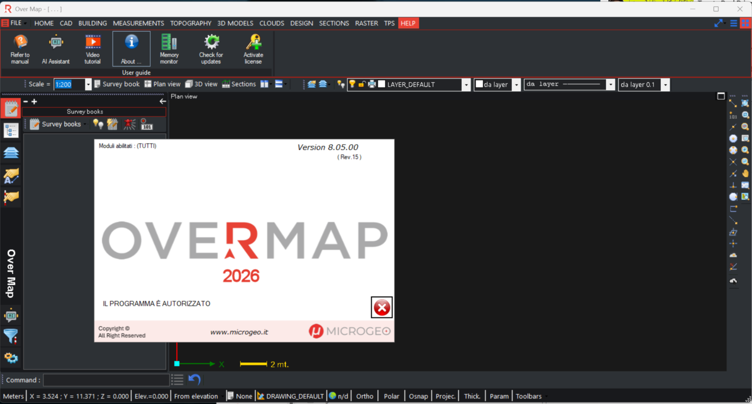
Microgeo OverMap Latest Updates positions itself as a modern geospatial mapping and spatial data management solution designed for professionals who require accuracy, speed, and flexibility in handling complex geographic datasets. In a rapidly evolving GIS (Geographic Information Systems) landscape, this software focuses on improving mapping visualization, terrain modeling, and real-time data integration for industries such as urban planning, surveying, construction, environmental analysis, and infrastructure development.
What makes Microgeo OverMap stand out is its emphasis on workflow efficiency and data precision. The latest updates refine its rendering engine, improve dataset compatibility, and introduce smoother integration with CAD and remote sensing tools. For professionals dealing with layered spatial data, satellite imagery, or field-collected coordinates, the platform offers a structured environment where information can be analyzed, visualized, and exported with minimal friction.
This review explores its capabilities, real-world applications, performance behavior, and overall value in modern geospatial workflows.
Introduction
Microgeo OverMap Latest Updates is a geospatial analysis and mapping platform designed to simplify how professionals interact with spatial information. At its core, it brings together GIS mapping tools, data visualization systems, and analytical functions into a unified workspace.
Unlike basic mapping tools that focus only on visualization, this software emphasizes data intelligence. Users can process multiple geospatial layers, apply analytical models, and generate actionable insights from raw coordinates or terrain data.
The latest version introduces improvements aimed at large-scale datasets, making it suitable for enterprise-level mapping operations as well as specialized technical use cases. Whether dealing with city-scale infrastructure planning or environmental terrain mapping, the system provides a structured workflow that reduces manual complexity.
Key Features
Microgeo OverMap Latest Updates includes a wide range of functionalities tailored for professional GIS and mapping workflows.
Advanced Geospatial Data Processing
The software supports multiple spatial data formats, allowing users to import vector and raster datasets seamlessly. It enhances compatibility with industry-standard GIS files, making cross-platform workflows easier.
High-Resolution Mapping Visualization
One of the most notable upgrades is improved rendering quality. Users can visualize high-density geographic data with smoother transitions, clearer terrain textures, and improved zoom scalability.
Multi-Layer Data Management
OverMap allows stacking of multiple data layers, such as elevation maps, infrastructure layouts, and environmental data. This layered approach improves decision-making by presenting complex information in an organized format.
CAD and GIS Integration
A major advantage of Microgeo OverMap Latest Updates is its ability to integrate with CAD-based workflows. Engineers and architects can align design data with geographic models for better planning accuracy.
Real-Time Data Synchronization
The software supports live data updates from connected sources. This is especially useful in dynamic environments such as construction monitoring or environmental tracking.
Terrain Modeling and Analysis Tools
Users can generate elevation models, slope analysis reports, and surface simulations. These tools help in understanding physical landscapes before project execution.
Automated Data Cleaning Tools
The system includes utilities for correcting inconsistencies in spatial datasets, reducing errors caused by incomplete or inaccurate inputs.
Export and Reporting Options
Users can export maps, datasets, and analytical reports in multiple formats for presentations, planning documents, or further analysis.
Practical Use Cases
Microgeo OverMap Latest Updates is built for industries that rely heavily on spatial intelligence. Its versatility allows it to adapt across different professional domains.
Urban Planning and Smart Cities
City planners can use the software to analyze land use patterns, infrastructure distribution, and population density mapping. It helps in designing more efficient transportation systems and zoning layouts.
Construction and Infrastructure Development
Engineers can overlay project designs onto real terrain models. This reduces planning errors and improves alignment between design and on-site conditions.
Environmental Monitoring
Environmental scientists can track changes in forests, water bodies, and landforms over time using layered satellite data and historical mapping records.
Surveying and Land Measurement
Surveyors benefit from precise coordinate mapping, elevation profiling, and boundary verification tools, which reduce manual calculations and field errors.
Utility and Energy Sector Planning
Power grid designers and pipeline engineers can map underground and surface infrastructure efficiently, ensuring better resource distribution planning.
Disaster Management and Risk Assessment
Authorities can simulate flood zones, landslide risks, and earthquake impact areas using terrain modeling features.
Performance Analysis
Performance is a critical aspect when working with geospatial datasets, which are often large and complex. Microgeo OverMap Latest Updates demonstrates improved stability and processing efficiency compared to earlier versions.
Speed and Responsiveness
The optimized rendering engine ensures smoother navigation when handling high-resolution maps. Zooming, panning, and layer switching are noticeably more responsive, even with heavy datasets.
Data Handling Capacity
The software is capable of managing large-scale geospatial files without significant lag. This makes it suitable for enterprise GIS environments and government-level mapping projects.
System Resource Optimization
While GIS software typically requires high system resources, this version introduces better memory management, reducing unnecessary CPU load during visualization tasks.
Accuracy and Precision
Geospatial calculations such as distance measurement, elevation mapping, and coordinate alignment show high accuracy levels, making it reliable for technical decision-making.
Stability in Long Sessions
Extended mapping sessions remain stable, with minimal crashes or performance degradation, which is essential for professionals working on long-term analysis projects.
Pros & Cons
Pros
- Strong support for multi-layer geospatial data analysis
- Improved visualization quality for complex terrain models
- Compatible with CAD and GIS workflows
- Efficient handling of large datasets
- Useful across multiple industries including engineering, planning, and environmental science
- Enhanced real-time data synchronization features
- Reliable performance for professional workloads
Cons
- Requires moderate to high system specifications for optimal performance
- Learning curve for users new to GIS platforms
- Advanced features may require training for full utilization
- Limited accessibility for casual or non-technical users
Pricing & Plans
Microgeo OverMap Latest Updates is typically structured as a professional-grade software solution, and pricing may vary depending on licensing type and organizational needs.
Common Licensing Models
- Single-user professional license for independent analysts and engineers
- Enterprise licensing for organizations managing large-scale geospatial projects
- Educational or institutional licensing for academic use in GIS training environments
What Influences Pricing
- Number of active users
- Access to advanced analytics modules
- Integration capabilities with external GIS or CAD tools
- Level of technical support and update frequency
While exact pricing can differ based on distribution channels and deployment scale, the software is generally positioned as a mid-to-high tier professional GIS solution.
Microgeo OverMap 8.05 Download
Final Verdict
Microgeo OverMap Latest Updates delivers a strong, capability-driven solution for professionals working in geospatial analysis, mapping, and spatial data management. Its combination of improved visualization, CAD integration, and advanced terrain analysis tools makes it suitable for industries that depend on precision and reliable geographic intelligence.
The latest improvements strengthen its position as a practical GIS platform capable of handling both technical and large-scale mapping requirements. While it may require a learning curve and suitable hardware, the long-term benefits in accuracy, workflow efficiency, and data clarity are significant.
For professionals seeking a structured and modern geospatial mapping environment, Microgeo OverMap Latest Updates presents a compelling option worth serious consideration. Exploring its capabilities can significantly enhance how spatial data is interpreted, managed, and applied in real-world projects.



Reviews
There are no reviews yet.