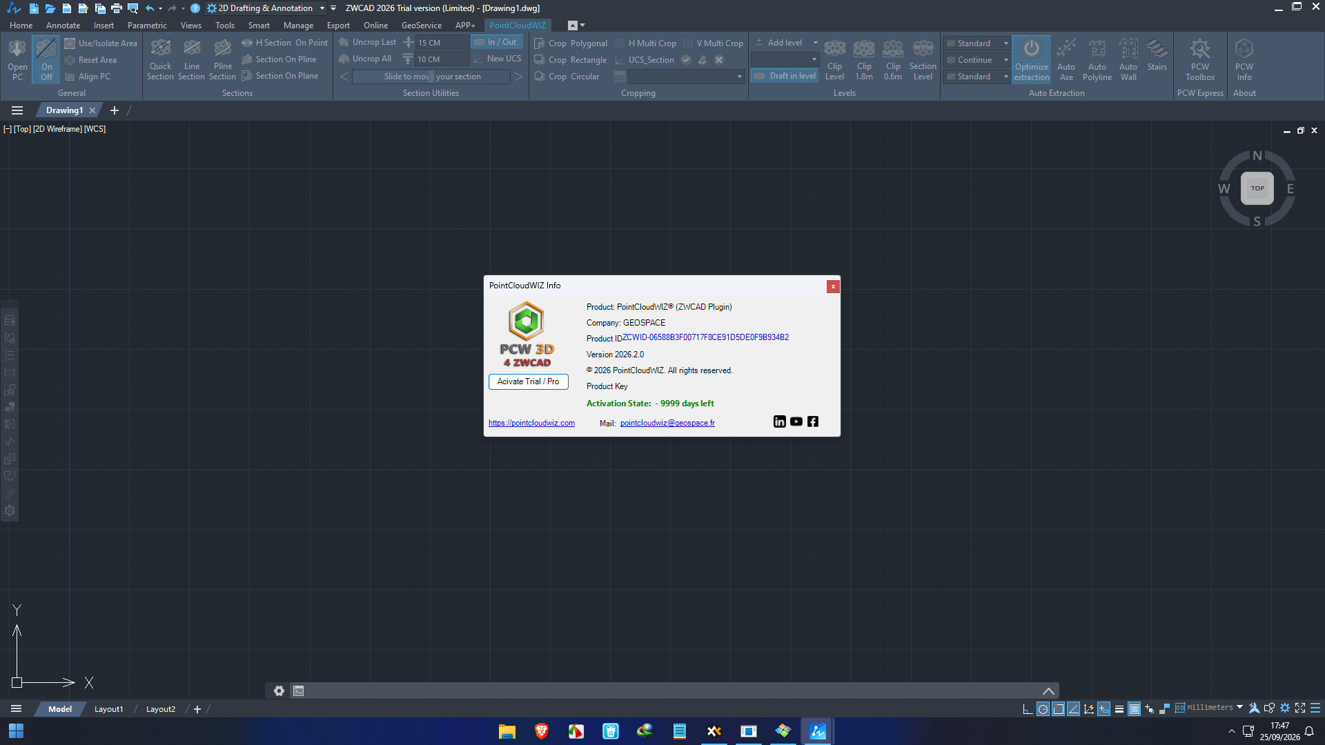
Description
PointCloudWIZ for ZWCAD 2026: Features, Benefits, Performance, and Complete Software
PointCloudWIZ for ZWCAD 2026 is a specialized point cloud processing solution designed to help CAD professionals work with scanned real-world environments inside a computer-aided design workflow. By combining point cloud data with ZWCAD-based drafting and design tasks, the software aims to simplify the process of transforming laser scanning information into useful CAD drawings, existing-condition plans, and project documentation.
For professionals working in surveying, architecture, civil engineering, construction, and renovation, point cloud technology can provide a valuable starting point for understanding existing structures and site conditions. Instead of relying entirely on manual measurements, designers can use scanned spatial data to examine geometry and develop drawings that reflect the physical environment more accurately.
PointCloudWIZ for ZWCAD is worth considering for teams that want to incorporate point cloud information into their existing CAD processes. Its practical value depends on supported file formats, available processing tools, project size, hardware capabilities, and compatibility with the installed ZWCAD version 2027. Understanding these factors is essential before choosing the software for professional use.
Introduction to PointCloudWIZ for ZWCAD
Modern construction and engineering projects frequently involve buildings, roads, industrial facilities, and other environments that already exist. Before modifying these spaces, project teams need reliable information about their current dimensions, layouts, and structural features.
Traditional surveying and manual measurement methods remain useful, but they can require substantial time when a project involves complex geometry or large areas. Laser scanning offers another approach by capturing millions of spatial points that collectively represent the shape and position of physical objects.
This information is commonly known as a point cloud. Depending on the scanning equipment and processing workflow, a point cloud may represent walls, floors, ceilings, structural components, terrain, equipment, and other physical features.
PointCloudWIZ for ZWCAD is intended for workflows in which point cloud information supports CAD-based design and documentation. The objective is to make scanned data more useful during the drafting process rather than treating it as a separate source of information.
Imagine an engineering team preparing renovation drawings for an older commercial building. Original plans may be incomplete, and some structural elements may have changed over time. A point cloud can help the team investigate existing conditions and create drawings based on the available scanned information.
For users already familiar with ZWCAD, a point cloud-oriented workflow can potentially reduce the disruption associated with switching between unrelated applications. However, the precise tools available depend on the product edition and version, so buyers should confirm specific capabilities before purchasing.
Key Features of PointCloudWIZ for ZWCAD
The following areas explain the principal capabilities to investigate when evaluating PointCloudWIZ for professional point cloud and CAD work. Exact functionality should be verified against the particular release being offered.
1. Point Cloud Integration with CAD Workflows
The central purpose of a point cloud CAD solution is to make scanned spatial information useful during drafting and design.
For ZWCAD users, the intended benefit is a workflow that connects real-world scan information with conventional CAD documentation. Designers can use scanned geometry as a reference when developing plans, examining existing structures, or documenting site conditions.
This approach is especially valuable when a project depends on the relationship between actual physical dimensions and proposed design changes.
2. Support for Existing-Condition Documentation
Existing-condition drawings are essential in renovation, refurbishment, building maintenance, and industrial modification projects.
Point cloud data can help CAD professionals understand the geometry of an existing environment before preparing documentation. When the relevant data can be displayed and examined effectively, it may support the creation of floor plans, sections, elevations, and other drawings.
The final accuracy still depends on scan quality, registration, measurement procedures, and the drafting process.
3. Reference-Based Drafting
A point cloud can serve as a visual and spatial reference while a designer creates conventional CAD geometry.
For example, an engineer preparing a factory layout may need to document columns, equipment locations, access routes, and structural boundaries. Working from scanned information can help establish the relationship between these elements and the proposed design.
Reference-based drafting also helps teams identify discrepancies between original drawings and the conditions recorded during a site survey.
4. Integration with ZWCAD
Compatibility with the existing CAD environment is an important consideration for any specialist add-on.
Professionals already using ZWCAD may prefer tools that complement their established drafting practices instead of requiring a complete change in their software ecosystem.
Before installation, users should confirm the supported ZWCAD release, operating system requirements, installation procedure, licensing arrangements, and any additional dependencies.
5. Support for Surveying and Engineering Workflows
Point cloud processing is relevant to several professional disciplines, including land surveying, civil engineering, architecture, and industrial design.
The usefulness of PointCloudWIZ for these applications depends on the available measurement, viewing, import, processing, and export capabilities. Users should distinguish between features confirmed by the product documentation and functions that may require separate applications.
This verification helps ensure that the software matches the actual requirements of a project.
Practical Use Cases of PointCloudWIZ for ZWCAD
Architectural Renovation and Building Surveys
Renovation projects often begin with uncertainty. Walls may have been moved, ceilings may conceal structural elements, and historical drawings may no longer represent the building accurately.
A point cloud-based CAD workflow can help architects and drafting professionals examine existing conditions before preparing renovation plans. It can also provide a useful reference when documenting building layouts for future maintenance.
For example, a design team renovating an office floor could use scanned information to investigate room boundaries, structural positions, and visible service installations before finalizing a proposed layout.
The benefit is a more informed design process, provided the scans contain sufficient detail and are interpreted correctly.
Civil Engineering and Infrastructure
Roads, bridges, drainage systems, and other infrastructure assets frequently require documentation of existing conditions.
Point cloud data can capture complex surfaces and structures that would otherwise require extensive manual measurement. When incorporated into a compatible CAD workflow, this information can help engineers prepare drawings and investigate potential design constraints.
A civil engineering team working on an existing roadway, for instance, may need to understand the geometry of surrounding structures and visible site features before planning modifications.
The effectiveness of this workflow depends on suitable survey data, coordinate handling, and the capabilities of the chosen software.
Industrial Facilities and Plant Layouts
Industrial environments can contain dense arrangements of machinery, support structures, pipes, and access routes.
Accurate documentation is important when planning equipment replacements, relocating machinery, or modifying production areas. Point cloud information can provide a visual record of the existing environment and help designers investigate spatial constraints.
For CAD professionals, this can make it easier to prepare reference drawings and identify potential conflicts before changes are implemented on-site.
Surveying and As-Built Documentation
Surveyors and CAD technicians often need to turn collected field information into clear, usable project drawings.
Point cloud data can provide a detailed representation of a surveyed environment, while CAD tools help transform that information into organized documentation.
PointCloudWIZ for ZWCAD may be relevant to teams seeking to connect these stages within a ZWCAD-centered workflow. Before adopting it for deliverables that require strict tolerances, users should test measurement reliability, coordinate consistency, and export quality.
Construction Planning and Site Coordination
Construction teams benefit from understanding the relationship between planned work and actual site conditions.
Scanned information can support preliminary checks, existing-condition reviews, and the preparation of drawings for coordination meetings. It may also help teams investigate discrepancies between design assumptions and the visible built environment.
However, a point cloud should not automatically be treated as proof that every concealed element or structural condition has been captured. Site verification remains important wherever safety, compliance, or precise construction tolerances are involved.
Performance Analysis
The performance of PointCloudWIZ for ZWCAD should be evaluated in terms of responsiveness, data handling, drafting efficiency, accuracy, and compatibility with existing project workflows.
Because independently verified benchmarks for this specific product have not been established here, the following analysis focuses on practical evaluation criteria rather than unsupported performance claims.
Processing Speed and Responsiveness
Point cloud datasets can contain millions or even billions of points, depending on the scanning equipment and project scope. Large datasets can place considerable demands on computer memory, processor performance, graphics hardware, and storage.
When evaluating PointCloudWIZ for ZWCAD, test the software with a representative project rather than relying exclusively on a small demonstration file. Observe how quickly the application loads the data, responds to navigation, and performs the operations required by your workflow.
A workstation with sufficient RAM, a capable processor, suitable graphics hardware, and a fast SSD can improve the overall experience. Actual performance will depend on the software’s implementation and the size and complexity of the dataset.
Drafting Efficiency
One of the most important performance measures is the time required to turn scanned information into usable CAD documentation.
A practical comparison involves completing the same drawing task using your existing workflow and then using PointCloudWIZ for ZWCAD. Record the time spent importing data, identifying reference geometry, preparing drawings, correcting errors, and exporting deliverables.
This approach helps determine whether the software delivers measurable productivity improvements for your particular projects.
Accuracy and Reliability
Point cloud processing does not automatically guarantee accurate drawings. Measurement reliability depends on the scanner, survey methodology, registration quality, coordinate systems, and the procedures used to create CAD geometry.
Before using the software for engineering deliverables, check whether dimensions and reference positions remain consistent throughout the workflow. Compare selected measurements against independently verified control points or field measurements when appropriate.
Compatibility and Stability
Compatibility is particularly important when working with established CAD projects and shared production environments.
Test the software with your current ZWCAD installation and representative project files. Check for unexpected application errors, file compatibility issues, display problems, and difficulties transferring data between team members.
A successful evaluation should demonstrate that the software fits into your actual production environment, not simply that it works in an isolated demonstration.
Pros and Cons of PointCloudWIZ for ZWCAD
Every specialist CAD tool should be evaluated against its intended use, technical limitations, and total cost of ownership.
Pros
- CAD-focused workflow: Designed around the needs of professionals working with ZWCAD and scanned spatial information.
- Potential time savings: Point cloud references may reduce dependence on repeated manual measurements when suitable scan data is available.
- Useful for existing buildings: Can support workflows involving renovation surveys, as-built documentation, and existing-condition drawings.
- Relevant to multiple industries: Point cloud-based workflows are useful in architecture, surveying, civil engineering, construction, and industrial projects.
- Opportunity for workflow consolidation: A compatible add-on may help users keep more of their drafting process within a familiar CAD environment.
- Better access to site information: Scanned references can help designers investigate physical conditions before committing to proposed changes.
Cons
- Version compatibility must be checked: The available functionality may depend on the installed ZWCAD version and the particular product release.
- Hardware demands can be significant: Large point cloud datasets may require a well-equipped workstation.
- Learning time is still necessary: Users must understand point cloud data, coordinate systems, and appropriate drafting practices.
- Accuracy depends on source data: Poor scans, incomplete coverage, or registration errors can affect downstream drawings.
- Feature availability requires verification: Specific import formats, editing tools, measurement functions, and export options should not be assumed without documentation.
- Licensing costs may vary: The total expense depends on the applicable edition, licensing model, and any additional software requirements.
Pricing and Plans
The exact current price, licensing structure, and available editions of PointCloudWIZ for ZWCAD could not be independently verified for this review. Consequently, assigning a specific price would risk misleading potential buyers.
Before purchasing, confirm the following details with the software seller:
- License type: Determine whether the product is offered as a perpetual license, subscription, or another licensing arrangement.
- Included features: Verify which point cloud tools and file formats are included in the quoted edition.
- ZWCAD compatibility: Confirm that the license supports your installed version.
- Updates and upgrades: Ask whether future releases and compatibility updates are included.
- Technical support: Establish what assistance is available for installation, licensing, and troubleshooting.
- Trial or demonstration availability: If offered, evaluate the product with a real project before committing financially.
For businesses, the purchase decision should consider more than the initial license fee. Time saved during drafting, reduced rework, staff training, and ongoing maintenance can all affect the overall value.
A less expensive product may not be the better choice if it lacks essential functionality. Similarly, a more expensive solution may be difficult to justify if the project requirements are relatively simple.
Who Should Use PointCloudWIZ for ZWCAD?
PointCloudWIZ for ZWCAD is worth investigating for professionals who regularly work with scanned environments and need to produce CAD documentation from existing conditions.
Architects and building designers may find a point cloud workflow useful when preparing renovation plans and documenting existing structures.
Surveyors and CAD technicians may benefit from connecting spatial survey information with their drawing production processes.
Civil engineers may consider the software for projects involving existing infrastructure, terrain-related documentation, or site coordination, subject to the available features.
Construction and industrial teams may find value in workflows that use scanned references to document facilities and investigate physical constraints.
On the other hand, occasional CAD users who rarely encounter point cloud data may not need a dedicated solution. They should first establish whether their existing tools already meet their requirements.
Tips for Getting the Best Results
A successful point cloud workflow starts with good preparation.
- Prepare the source data. Confirm that scans are complete, correctly registered, and suitable for the intended project.
- Check coordinate systems. Verify units, reference coordinates, and alignment before beginning detailed drafting.
- Use representative test files. Evaluate both small and large datasets to understand practical performance limitations.
- Maintain organized drawings. Use a consistent layer structure, naming conventions, and project documentation standards.
- Verify critical dimensions. Compare important measurements against trusted references before issuing final drawings.
- Train the project team. Ensure that users understand the workflow, supported features, and limitations of point cloud-derived geometry.
- Test deliverable compatibility. Confirm that exported drawings can be opened and used by colleagues, clients, and downstream applications.
These practices help reduce avoidable errors and make it easier to determine whether the software is suitable for ongoing professional use.
PointCloudWIZ for ZWCAD Developer
PointCloudWIZ for ZWCAD 2026.2.0 Download
Final Verdict
PointCloudWIZ for ZWCAD is a product worth evaluating for CAD professionals seeking a more connected workflow between point cloud information and conventional drafting. Its potential appeal lies in the practical challenges faced by architects, surveyors, engineers, and construction teams who need to document existing environments accurately and efficiently.




Reviews
There are no reviews yet.