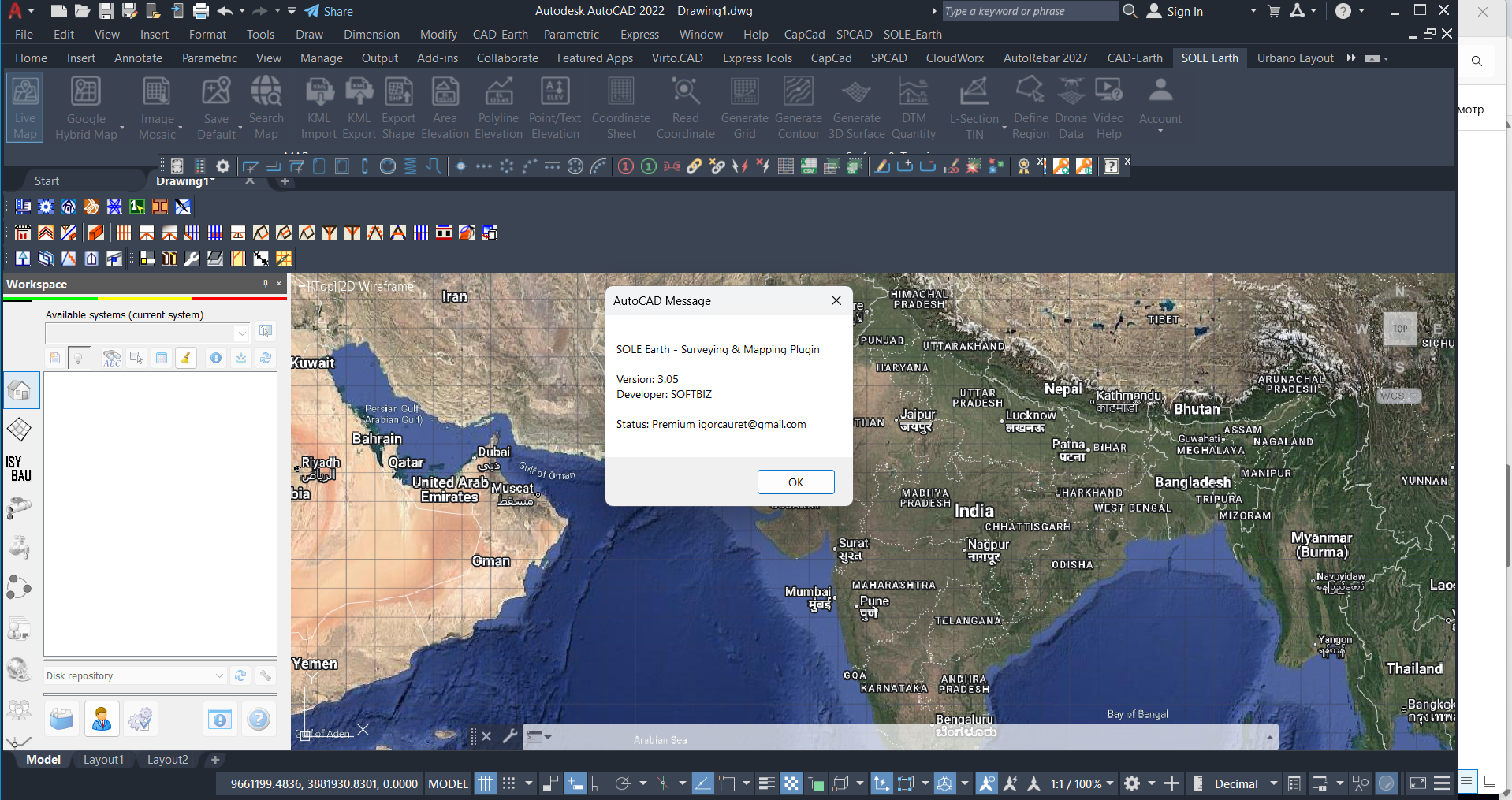
Description
SOLE Earth 3.05: A Practical Geospatial Tool for Smarter Earth Observation and Spatial Analysis
When working with geospatial data, the biggest challenge is often not collecting information but turning complex Earth-related data into something useful, understandable, and actionable. This is where SOLE Earth stands out. Designed for professionals and organizations working with geographic, environmental, and spatial information, SOLE Earth provides a focused environment for exploring, analyzing, and interpreting Earth-related data more efficiently.
Whether you are involved in environmental studies, land management, infrastructure planning, research, or geospatial analysis, the right software can significantly improve the way you work. Instead of dealing with disconnected datasets and time-consuming manual processes, a specialized platform can help bring important information together in a more organized workflow.
In this review, we take a closer look at SOLE Earth, including its key features, practical use cases, performance, benefits, limitations, and overall value. If you are searching for a capable Earth data and geospatial analysis solution, this detailed SOLE Earth review will help you understand where the software fits into a modern professional workflow.
Introduction to SOLE Earth
The Earth is a complex system. Land, water, climate, geology, infrastructure, ecosystems, and human development are all connected. Professionals working with this information need tools that can help them examine spatial relationships and understand changes across different locations.
SOLE Earth is designed for users who need to work with Earth-related information in a structured and analytical environment. Rather than relying only on general-purpose mapping applications, users can work with specialized spatial data and analytical workflows relevant to environmental and geographic projects.
The software can be particularly useful for organizations that need to evaluate terrain, land conditions, environmental factors, and other geospatial information. Its value becomes more apparent when a project involves multiple datasets, large geographic areas, or the need to compare information over time.
For many users, the main benefit of software like SOLE Earth is workflow efficiency. A well-organized geospatial platform can reduce repetitive tasks, improve data interpretation, and make it easier to communicate findings to colleagues, clients, stakeholders, and decision-makers.
Key Features of SOLE Earth
The exact workflow can vary depending on the project and the available data, but SOLE Earth offers a practical foundation for professionals who need to work with Earth-focused spatial information.
Geospatial Data Analysis
One of the core strengths of SOLE Earth is its focus on geospatial data. Users can examine information according to geographic location and spatial relationships.
This can help answer practical questions such as:
- Where are specific environmental conditions occurring?
- How do different geographic areas compare?
- What areas may be suitable for a particular project?
- How are land or environmental conditions changing?
- Which spatial factors could influence a planning decision?
By analyzing information in a geographic context, professionals can move beyond simple tables and reports and gain a clearer understanding of real-world conditions.
Organized Spatial Workflows
Geospatial projects often involve many layers of information. Without a structured workflow, it can become difficult to keep data organized.
SOLE Earth can help users approach spatial projects in a more systematic way. Instead of treating every dataset as an isolated file, users can analyze information as part of a broader geographic workflow.
This is particularly useful for:
- Environmental assessments
- Land analysis
- Geographic research
- Site evaluation
- Infrastructure planning
- Resource management
Earth and Environmental Data Interpretation
Many professionals need to understand how physical and environmental conditions affect a project. SOLE Earth can support the interpretation of Earth-related information by helping users examine geographic patterns and relationships.
For example, a project team may need to study a region before making decisions about land use, development, conservation, or infrastructure. A spatial analysis platform can help organize the relevant information and make the analysis more understandable.
Support for Professional Analysis
SOLE Earth is intended for more than casual map viewing. Its value is strongest when used as part of a professional analytical workflow.
Researchers, environmental specialists, planners, engineers, and other technical users can benefit from tools that allow them to study geographic information with greater consistency.
The ability to work with spatial information in a dedicated environment can help reduce reliance on manual interpretation and improve the repeatability of project workflows.
Practical Use Cases
One of the best ways to understand the value of SOLE Earth is to look at how it may be used in real-world situations.
Environmental Assessment
Environmental consultants often need to evaluate land, natural conditions, and potential environmental impacts. SOLE Earth can help organize and analyze spatial information relevant to these assessments.
A typical workflow might involve reviewing geographic information, identifying important areas, comparing environmental conditions, and preparing findings for a project report.
For a consultant managing multiple projects, having a structured geospatial workflow can save considerable time.
Land and Site Evaluation
Before a construction, development, or infrastructure project begins, it is important to understand the characteristics of the proposed site.
Professionals may need to evaluate:
- Terrain and geographic conditions
- Surrounding land use
- Environmental constraints
- Regional patterns
- Potential risks
- Spatial relationships between different features
SOLE Earth can provide a useful environment for studying this information and supporting better-informed decisions.
Research and Academic Projects
Researchers working in geography, environmental science, Earth science, and related fields often work with complex spatial datasets.
A specialized platform can help researchers explore geographic relationships, identify patterns, and organize information for further analysis.
For students and researchers, the ability to examine Earth-related information visually and spatially can make complex subjects easier to understand.
Infrastructure and Planning
Large infrastructure projects require careful planning. Roads, utilities, industrial facilities, energy projects, and other developments may be influenced by geographic and environmental factors.
Using a geospatial analysis solution such as SOLE Earth can help project teams examine the wider context surrounding a proposed development.
This may improve early-stage planning and help identify potential issues before they become expensive problems.
Natural Resource Management
Land, water, and environmental resources must be managed using accurate information. Geographic analysis can support planning and monitoring activities related to natural resources.
Organizations can use spatial information to better understand regional conditions and identify changes that may require attention.
Performance Analysis
Performance is an important consideration for any professional software. A tool can have impressive capabilities, but if it feels slow, confusing, or difficult to manage, users may struggle to integrate it into daily work.
SOLE Earth is best viewed as a specialized solution for users who need focused Earth and spatial analysis capabilities. Its performance will naturally depend on the size of the datasets, the complexity of the analysis, and the user’s computer environment.
For standard professional workflows, the software can provide a practical foundation for organizing and examining spatial information.
Workflow Efficiency
The biggest performance advantage of a dedicated geospatial tool is often not raw speed but improved workflow efficiency.
When users can work with relevant spatial information in one organized environment, they may spend less time switching between unrelated applications and manually comparing data.
Data Handling
Geospatial projects can involve large and complex datasets. Performance may vary depending on project size and data complexity, but a specialized workflow can still make data management more practical.
Users working on larger projects should always consider hardware specifications, dataset size, and project requirements when evaluating software performance.
Learning Curve
As with most professional geospatial software, new users may need time to understand the interface and available workflows.
However, users with experience in geographic information systems, environmental analysis, or spatial data management are likely to find the overall concept easier to understand.
The learning curve is generally a worthwhile investment for professionals who regularly work with Earth-related data.
User Experience
A common experience among users of specialized technical software is that the first few sessions can feel more complex than expected. This is normal, particularly when the software is designed for professional analysis rather than casual use.
With regular use, workflows can become more familiar. Professionals who work with similar types of geographic information on a regular basis may benefit from the repeatability of a dedicated system.
The strongest user experience is likely to come from organizations that already have a clear workflow for managing spatial information. When the software is used as part of a broader process involving data preparation, analysis, reporting, and decision-making, its practical value becomes more apparent.
Pros and Cons of SOLE Earth
Pros
- Focused on Earth-related and geospatial workflows
- Useful for environmental and geographic analysis
- Supports structured spatial data interpretation
- Suitable for research, planning, and professional projects
- Can improve workflow organization
- Helps users analyze information in a geographic context
- Valuable for technical users who need specialized tools
Cons
- May require time for new users to learn
- Advanced workflows can be complex for beginners
- Performance depends on data size and system hardware
- May be more specialized than casual users require
- The value is highest for users with genuine geospatial analysis needs
Pricing and Plans
Pricing for professional software can vary depending on the licensing model, edition, updates, support, and organizational requirements. Because software pricing and availability can change over time, prospective users should evaluate the current licensing options that apply to their specific use case.
For businesses and professional organizations, the most important factor is often not the initial software cost but the value created through improved productivity and more efficient analysis.
If SOLE Earth helps a team reduce manual data processing, improve project planning, or make better-informed geographic decisions, the software can potentially deliver significant long-term value.
Who Should Use SOLE Earth?
SOLE Earth may be a strong choice for users who regularly work with geographic and Earth-related information.
It can be especially relevant for:
- Environmental consultants
- Geospatial professionals
- Researchers and academics
- Land-use planners
- Infrastructure teams
- Earth science specialists
- Natural resource professionals
- Organizations involved in spatial analysis
It may be less suitable for users who only need basic maps or simple location visualization. In those situations, a lightweight mapping tool may be sufficient.
However, for users who need a more specialized environment for studying Earth-related spatial information, SOLE Earth offers a more focused approach.
Final Verdict
SOLE Earth is a specialized solution for professionals who need to understand the world through geographic and Earth-related data. Its biggest strength is its ability to support structured spatial analysis and help users connect data with real-world locations.
From environmental assessments and site evaluation to research, infrastructure planning, and resource management, the software can support a wide range of professional workflows.
The main advantage of SOLE Earth is not simply the ability to view geographic information. Its real value comes from helping users analyze spatial relationships, organize complex information, and make better-informed decisions.
Like any professional technical software, it may require a learning period, especially for users who are new to geospatial analysis. However, users who regularly work with Earth data can benefit from investing time in learning the platform.
Overall, SOLE Earth is worth exploring for professionals and organizations looking for a focused approach to Earth observation, geographic data analysis, and spatial information management. If your work involves understanding land, environmental conditions, geographic patterns, or spatial relationships, exploring SOLE Earth could be a practical next step toward a more efficient and informed analytical workflow.




Reviews
There are no reviews yet.